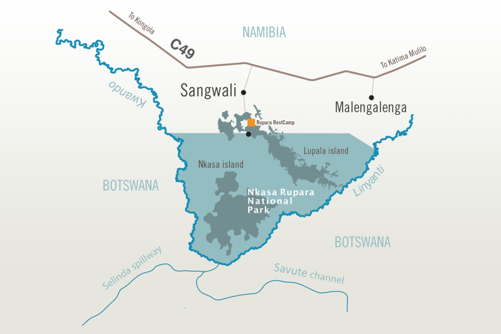
Despite its modest size of 337 square kilometers, Nkasa Rupara National Park stands as Namibia’s largest formally protected wetland region. Comprising reed beds, lagoons, and islands, the majority of the park hosts diverse wildlife, including elephants and buffalo. The park’s hydrological functioning and biological significance closely resemble the Okavango Delta, resulting in periodic floods and fluctuating water levels that transform the environment from a wetland to a dry, dusty landscape.
Nkasa Rupara plays a crucial role as a transboundary corridor for wildlife migration between Angola, Botswana, Namibia, and Zambia. It facilitates seasonal movements to and from rivers due to its unfenced nature.
PARK’S HISTORICAL BACKGROUND
The marshes of Nkasa Rupara, utilized by hunter-gatherers and fishers for millennia, remained marginally inhabited by humans. In the 1700s, the BaYeyi resided near the Linyanti River and Nkasa Island, sustaining themselves through agriculture and fishing. For nearly two centuries, the BaLozi and MaKololo Empires held sway, influencing regional alliances involving the BaYeyi, MaFwe, and HaMbukushu. Simataa Kabende, chief of the MaFwe, was appointed to safeguard the southern kingdom (encompassing present-day Nkasa Rupara) and bestowed the title Mamili by the BaLozi King in 1865, during the second BaLozi reign. This designation endured through Simataa’s successors, becoming the park’s original name when declared Mamili National Park in 1990. Post-independence, it was commonly referred to as Nkasa Lupala NP and officially redesignated Nkasa Rupara NP in 2012.
Kwando-Linyanti Marshes
consistently filled main channels of the Kwando/Linyanti Rivers, interspersed with periodically flooded channels and hosting Namibia’s largest seasonally inundated grasslands. This unique ecosystem, reminiscent of the renowned Okavango Delta, includes wooded islands with rare tree species, making it distinctive on a national scale. The Kwando/Linyanti Rivers, with a relatively small catchment area primarily in Angola, contribute to dynamic river flooding patterns, causing intermittent dryness in certain areas in some years and complete inundation in others.
The Marshes exemplify the intricate interplay of environmental elements, with recurrent flooding as the key force shaping the park’s ecology. This phenomenon intricately regulates the distribution of woody vegetation, mainly thriving on elevated, infrequently wet ‘islands,’ adding complexity and intrigue to this remarkable natural landscape.


